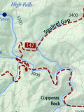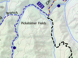
Front of the map.
The guys with Pisgah Map Company – Pete Kennedy and Jack Mohr – have released a fantastic new competitor to the old Trails Illustrated map #780 (Pisgah Ranger District) by National Geographic. Called the Western North Carolina Trail Guide, the new map covers the South Pisgah Ranger District including Bent Creek. And like the Trails Illustrated map, this one has a topographic base layer with hill shading, and is printed on waterproof, smear-proof paper. They’re the same physical size, and both show almost all of the trails in the Pisgah district, color-coding them black, blue, and red for hike, hike/bike, and hike/bike/horse use respectively.
However, the new Western North Carolina Trail Guide boasts many improvements over the Trails Illustrated map. It rotates the view 90 degrees so that the areas which contain trails cover more of the map. Also, there’s no overlap in coverage between the front and back of the map like there is with the Trails Illustrated map. Davidson River, Mills River, Middle Prong & Shining Rock Wilderness areas are all on one side of the map, and Bent Creek is on the other. This allows the map to be at a larger scale across the entire area, and since Bent Creek (which has a dense network of trails) is on its own side, it’s shown at an even larger scale yet, making it easier to distinguish between the individual routes there.

Great level of detail in the tight areas, and trail names right beside the trail.
In addition to the standard numbered index, the new map prints the trail names right on the map beside the trails – an obvious but greatly appreciated feature, made possible in part by the larger scale. No more hunting for the name of a trail in a huge list based on the little number printed beside it. And the trails are just more accurately placed – these guys have taken a lot of time to ensure accuracy of the map data, and it shows! Especially in the small, compact, confusing intersections, where details matter most. This is the second edition of the map, and several improvements have been made over the first edition, further illustrating their commitment to quality and accuracy.

You won’t find these waterfalls on the Trails Illustrated map, but you’ll see them along the trail.
There are tons more waterfalls on the new map than the Trails Illustrated map, and since they’re one of the most popular destinations in the forest it’s a great help when you’re hunting for them.
Finally, the map includes a healthy series of mountain bike ride descriptions to get you started, so it’ll make a great all-in-one guide for someone getting started riding in the area, or looking for something new to try. These include stats, directions, and a neat elevation profile which allows you to easily compare length and climbing between the different rides.
I had a chance to meet with Pete last week to get a copy of the map and talk a little shop about GIS, find out more about what he’s trying to do, and how the company works. I can tell that they’re passionate about this product, and it shows. Not only do you have some top-notch cartographers behind this map, but they’re locals, and know the local trails. By buying this map, you’re supporting local businesses and the local outdoors community – a portion of the proceeds are even donated toward trail maintenance! This will definitely be the paper map I recommend for trips into the Pisgah District.
Pick up a copy of the map at one of the local outfitters or bike shops on this page. One of these stores should be on your way to the trails from where you’re located!

New DuPont State Forest Map by Pisgah Map Company
[…] one of DuPont State (Recreational) Forest. Like the Pisgah Ranger District map published in 2011 (which we also reviewed), this is another fantastic publication made by locals who are not only trail experts, but whose […]